|
|
|
Tara Bodies |
|||||||||||||||||||||||||||||||||||||||||||||||||||
At least three extended inhumations, two in stone-lined graves, oriented east / west were identified by testing at Collierstown 1(Section 2).
These previously unknown burials had no surface indication, however, they were located adjacent to a small mound (Mound 1; c. 9.7m diameter and 0.4m high). A hand-excavated trench across the mound did not reveal any evidence of burial, enclosing ditch or function. Despite the lack of evidence this mound is still considered to be a possible prehistoric burial site. However, it is also possible that the proximity of the cists to the mound is coincidental.
This earthen mound is one of four in the field, all located parallel to, and approximately 10m from the Collierstown road and it is possible that they are related to ditch clearance for roadside drainage. If the mounds are barrows their location in a row parallel to the road is unusual considering that the nearby stream, perpendicular to the road, is the townland boundary, where barrows might be more typically located. Extended supine inhumations in stone-lined graves, on an E-W orientation, are typically dated from the fourth century AD onwards. In some cases, these may have been the burials of the earliest Christians, during the Iron Age / Early Christian transition. It is also interesting that these graves are often placed on or close-to Bronze Age or Iron Age burial mounds or standing stones, suggesting that communities sought to establish a link with the ancestors at a time of social and ideological change.
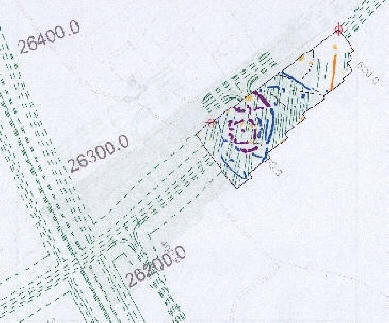
Geophysical survey, both magnetometer and resistivity survey, has been undertaken at Collierstown 1. Three stone-lined graves and a number of other features were found in testing. The geophysical survey revealed that these features are ditched enclosures surrounding the burials.
Figure 1 The geophysical interpretation (shown above in Figure 1) is based on the greyscale image from the geophysical survey (shown below in Figure 2). Features of archaeological potential (and other anomalies such as ploughing trends) are visible in the greyscale image as dark lines against the lighter grey background.
Each of these features or anomalies is distinguished in
the geophysical interpretation as Archaeology
(continuous purple line), Possible Archaeology
(continuous blue line), Possible Ploughing Trend
(dot/dash dark green line), Trend (dashed black line),
Former Boundary (orange) or Ferrous (yellow). These
features are shown in Figure 3 below in relation
to the CPO landtake of the proposed M3 road, which is
indicated on the drawing by dark green dashed lines. Preliminary Excavation ResultsPreliminary analysis has concluded that the site developed from an Iron Age ring ditch incorporating a number of inhumations and possible cremations, into an early medieval cemetery, with subsequent post-medieval and modern drainage activity. In total 62 articulated human inhumations (preliminary assessment: 24 female, 19 male, 19 unsexed (including 3 neonates) were identified, with quantities of disarticulated human bone found in some graves. This was particularly evident at the centre of the cemetery where there was the greatest incidences of truncation by later graves. The burials were in stone-lined, wood-lined or pit graves. Evidence for wood-lined burials is rare in Ireland, and the five examples from Collierstown add significantly to the corpus of the known examples. That the majority of burials were not associated with grave goods, and were orientated west/east, which suggested they were Christian burials in the native tradition of burial. Finds from the site included flint objects such as a hollow-based arrowhead, imported early medieval Mediterranean pottery, Dublin-type ware (the medieval fabrics probably introduced through manuring and ploughing), a copper-alloy chain-ring fragment, a spiral-headed ring-pin, a bone toggle, bone comb side plate, fragments of wooden objects including a stave and a stake.
Fig. 3
Elevated view of Collierstown showing grave cuts and
large ditches
(Hawkeye
Ltd)
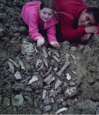
Fig. 1 Archaeologists carefully
excavating skeleton on Collierstown
Fig. 2 Stone lined coffin with skeleton
from Collierstown
Artefacts
Fig. 4 Bronze Ring Pin likely to have been used as a dress fastener (ACS Ltd)
Return to Section 2.
|
|
|
|
|
|
||||||||||||||||||||||||||||||||||||||||||||||
![]()
![]()
![]()
![]()
![]()
![]()
![]()
![]()
![]()
![]()
![]()
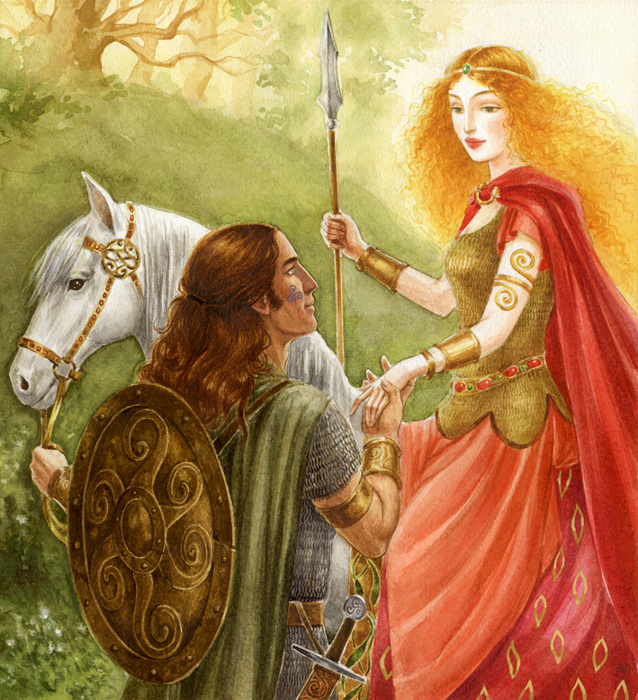 Oisin and Niamh |
![]()
![]()
![]()
![]()
![]()
![]()
![]()
![]()
![]()
![]()
![]()

![]()
Tara Tara Tara
Please contact for any questions: anitagreg@gmail.com
|
Colm Toibin |
|
|
|
|

![]()
![]()
![]()

