|
The geophysical survey carried out as part of the Environmental Impact Statement identified a probable medieval moated site (c .60m
x 60m) in Garretstown townland (at Garretstown 2). The medieval moated
site at Garretstown 2 lies outside the roadtake, as the road was moved
to avoid the square enclosure, but external features including
industrial and agricultural activity have been exposed.
|
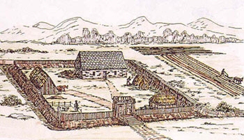
Artist's impression of a medieval moated site (after Billy Colfer).
These were well-defended farmsteads usually on the margins of Norman
territory.
http://www.m3motorway.ie/Archaeology/Section2/Garretstown2/
|